Sargassum in Quintana Roo — What April Looks Like Across Every Beach (2026)
April is the moment sargassum season shifts from "maybe" to "definitely." Here's what the data shows right now — beach by beach, destination by destination — and how to make the most of your trip this month.
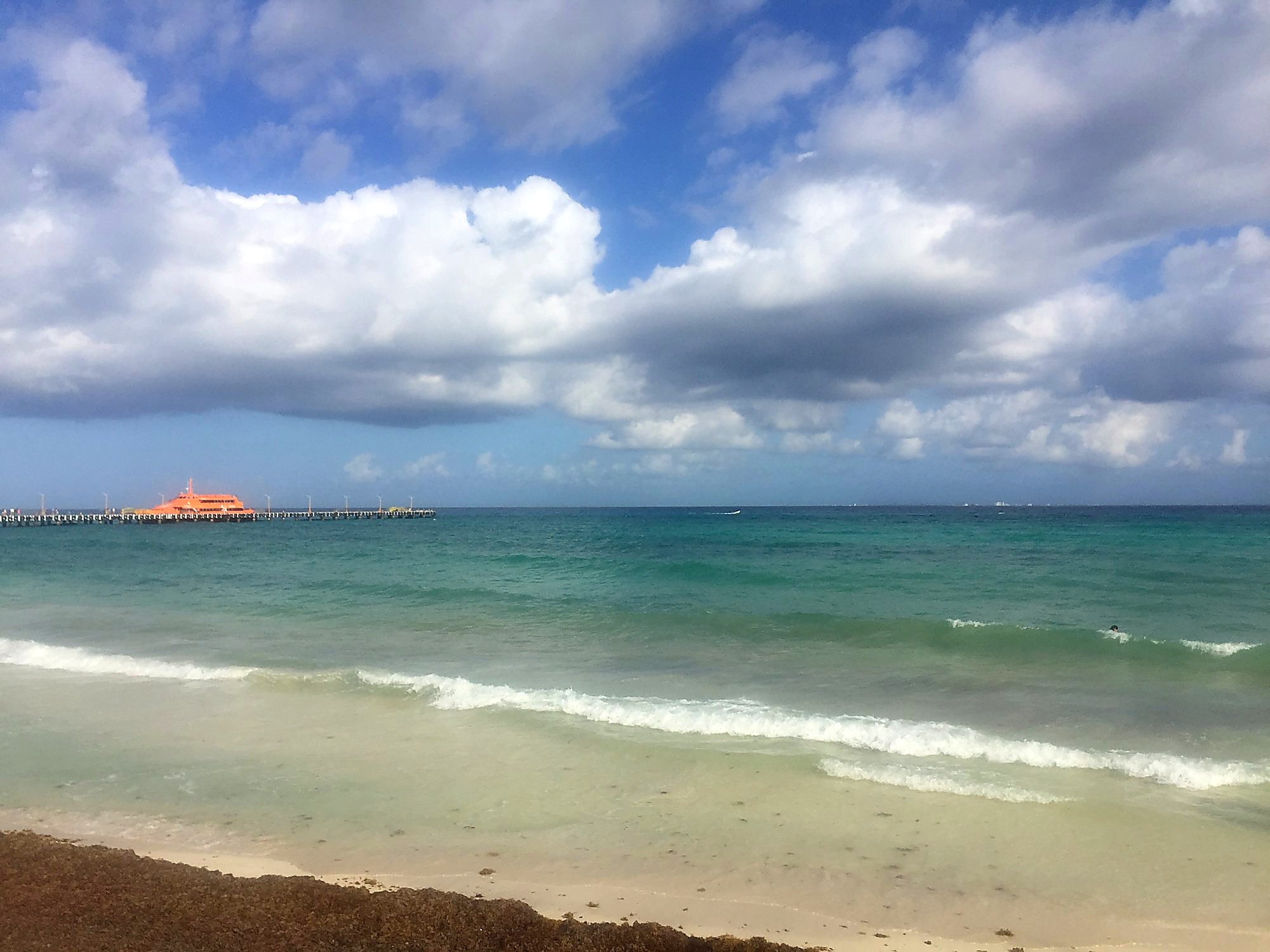
Check Today's Live Map
Real-time sargassum status across all 9 beaches — updated hourly.
Why April Is the Turning Point
March in Quintana Roo is unpredictable — some years are pristine, others see early arrivals. April is different. By early April, the Atlantic sargassum belt has typically grown large enough and the Caribbean currents have shifted enough that arrivals become increasingly regular across the region. 2026 is no exception.
The driver right now is wind direction. Southeast winds — currently blowing at 25–35 km/h along the North Zone coast and 20–30 km/h in the South Zone — push open-ocean sargassum mats directly toward the coastline. When the wind holds this pattern for multiple days, accumulation builds quickly at east and southeast-facing beaches. The good news: not all beaches face the same direction, and geography creates real winners and losers in April.
📡 Current Data — April 2, 2026
Official monitoring by CEMAS (Centro de Monitoreo Ambiental y Sargazo, SEMA Quintana Roo) is tracking 140 beaches across the state. North Zone: 12 beaches at excessive levels, 45 at low. South Zone: 22 of 40 beaches at excessive levels. Southeast winds and 1.7–1.8 m swell are the primary drivers today.
Beach-by-Beach: April 2026 Breakdown
Here's what April conditions actually look like at each of the major tourist destinations — and which ones are holding up best.
Cancún Hotel Zone
Cancún's Hotel Zone runs in a distinctive curve, and that curve is your friend in April. The northern section — where most of the large all-inclusive resorts sit — faces more to the northeast, which offers some natural protection during southeast wind events. Beaches like Playa Tortugas, Playa Las Perlas, and Playa Langosta in the north of the strip tend to accumulate less than the southern stretch around Punta Nizuc and Playa Delfines, which face more directly into the sargassum current.
In a southeast wind pattern like today's, this difference is meaningful. If you're currently in Cancún and the beach at your hotel is heavy, walking or busing north along the Hotel Zone strip is often worth it — conditions can differ significantly within just a few kilometers.
Live Cancún Beach Status
Isla Mujeres
Isla Mujeres is one of the most consistent performers during April southeast wind events, and the reason is pure geography. Playa Norte — the island's main tourist beach — faces west, sheltered by the island mass itself from the southeast swell driving sargassum arrivals. While the mainland is absorbing direct hits, Playa Norte is often clear to light.
The 15-minute ferry from Puerto Juárez or the 20-minute ferry from Cancún's hotel zone makes Isla Mujeres an easy escape plan if your Cancún beach is heavy today. It's one of the most reliable calls you can make in April.
Isla Mujeres live conditions →Puerto Morelos
Puerto Morelos sits between Cancún and Playa del Carmen and has a somewhat exposed east-facing beach. The offshore reef provides a partial buffer, but it's not enough to fully deflect sargassum during active southeast wind events. Both Puerto Morelos Norte and Centro are tracked in this week's data, and conditions have been mixed. It's not among the worst-hit areas, but it's not the safest bet in April either.
The town itself is charming and quieter than Cancún or PDC — if the beach is manageable, it's a lovely spot. Check conditions before making the drive.
Puerto Morelos live conditions →Cozumel
Cozumel is the most structurally protected major destination in Quintana Roo during southeast swell events — which is exactly the pattern driving April arrivals right now. The island sits about 18 km offshore, and its main tourist beaches all face west toward the Yucatán Channel. Southeast swells hit the island's east coast (which has no tourism infrastructure), dissipate across the island, and never reach the western shore with meaningful force.
Beaches like Chankanaab, Playa San Francisco, Playa Mia, and Playa Las Uvas are tracking at lower sargassum levels in this week's South Zone data — and the island's famous reefs remain world-class regardless of surface sargassum conditions. If you have flexibility to get to Cozumel this week, it's arguably the best beach call in the state right now.
Cozumel Snorkel & Reef Tour
Explore the famous Mesoamerican Reef — one of the world's best snorkeling sites.
Book on ViatorBooking via our affiliate link supports this site at no extra cost to you.
Tulum
Tulum's beaches face east — directly into the prevailing sargassum current. In April, as the season ramps up, Tulum (including the beaches near the ruins zone, the hotel zone north, and the hotel zone south) is among the first coastal stretches to see significant accumulation. It also has less centralized cleanup infrastructure than Cancún, so what arrives tends to stay longer.
That said, Tulum's beach club culture means the specific stretch in front of any given property is often managed with private cleanup crews. If you're staying at a Tulum beach club hotel, ask them directly about their morning routine. The raw public beach sections between properties are typically unmanaged.
⚠️ Tulum in April
Of all the destinations in this guide, Tulum requires the most active monitoring in April. Arrive early (before 9 AM) on days your property has run cleanup, or have a cenote day booked as a backup. The ruins are spectacular regardless of beach conditions.
Akumal
Akumal Bay has a natural advantage: the bay's curved shape and reef system create a partial buffer against open-ocean sargassum arrivals. It doesn't eliminate the problem, but it reduces peak accumulation compared to straight, exposed coastlines at the same latitude. April is variable for Akumal — some days the bay is clear and the turtle snorkeling is excellent, others see a sargassum line along the beach.
The snorkeling in Akumal remains worth doing even on days with some surface sargassum — visibility in the water column is usually unaffected, and the sea turtles are there year-round. Entry conditions in the morning are almost always better than afternoon.
Akumal live conditions →April 2026 at a Glance — Destination Comparison
| Destination | April Exposure | SE Wind Protection | Best Timing |
|---|---|---|---|
| North Cancún (Hotel Zone) | 🟡 Moderate | ✅ Partial (curves NE) | Early morning |
| South Cancún / Punta Nizuc | 🟠 Moderate–High | ❌ Directly exposed | Early morning only |
| Isla Mujeres (Playa Norte) | 🟢 Low | ✅ Strong (faces west) | All day |
| Puerto Morelos | 🟡 Moderate | ⚠️ Reef buffer only | Morning |
| Cozumel (west coast) | 🟢 Low | ✅ Very strong (island shield) | All day |
| Tulum | 🔴 High | ❌ Fully exposed east-facing | Before 9 AM or cenote day |
| Akumal | 🟡 Moderate | ⚠️ Bay + reef buffer | Morning snorkeling |
How to Navigate April Sargassum: Practical Tips
Tours Worth Booking for April (Sargassum-Proof)
These activities are completely unaffected by sargassum — and having one pre-booked means you always have a great day regardless of what the beach looks like.
Isla Mujeres Catamaran
Cruise across turquoise waters and jump off board to swim and snorkel among the reefs.
Book on ViatorBooking via our affiliate link supports this site at no extra cost to you.
Cancún Cenote Tour
Swim in the sacred underground cenotes of the Yucatán Peninsula — crystal clear freshwater, no seaweed.
Book on ViatorBooking via our affiliate link supports this site at no extra cost to you.
Chichén Itzá + Cenote Day Trip
Full-day tour to the iconic Mayan ruins with a swim in Ik Kil cenote and lunch in Valladolid.
Book on ViatorBooking via our affiliate link supports this site at no extra cost to you.
What to Pack for April in Quintana Roo
April sargassum conditions make a couple of items genuinely useful rather than optional.
Water Shoes
Lightweight mesh water shoes that drain instantly — essential for keeping your feet safe from sargasso, sea urchins, and sharp cenote edges.
View on AmazonAs an Amazon Associate we earn from qualifying purchases.
Reef Safe Mineral Sunscreen
Reef/cenote safe, mineral-based SPF 50. Required at many cenotes and recommended throughout the Riviera Maya.
View on AmazonAs an Amazon Associate we earn from qualifying purchases.
Dry Bag 10L
Keep your phone, wallet, and camera bone dry on boat tours, snorkeling trips, and beach days.
View on AmazonAs an Amazon Associate we earn from qualifying purchases.
Where to Stay This April
If you're still booking, staying at a well-managed resort with active sargassum cleanup crews makes a significant difference in April. These links search current availability by beach area — Expedia's filter tools let you sort by guest rating and free cancellation, which is useful when you want flexibility to move if conditions shift.
About the Data in This Article
Sargassum distribution data referenced in this article comes from the official Mapa Semáforo del Sargazo published by CEMAS (Centro de Monitoreo Ambiental y Sargazo), operated under SEMA Quintana Roo (Secretaría de Ecología y Medio Ambiente). CEMAS monitors 140 beaches across Quintana Roo's Caribbean coast and publishes traffic-light level assessments — Excessive, Abundant, Moderate, Low, and None — based on satellite and ground monitoring. This article was written on April 2, 2026 based on that day's published data.
For real-time conditions updated hourly at each of the 9 beaches we cover, use our live sargassum map.
Check Live Conditions Now
Real-time sargassum status for every beach — updated hourly.
View Live Beach Map


